
The Woodstock ZIP Code Directory at a Glance
Two principal USPS ZIP codes carry Woodstock mailing addresses. They cover broad delivery areas in southern Cherokee County and cannot be read as city-limit polygons. No separate PO-box-only or unique institutional Woodstock ZIP was confirmed, so this ZIP code directory does not invent one.
| ZIP | Woodstock area served | Postal verification | Boundary note |
|---|---|---|---|
| 30188 | Downtown/eastern side and broad surrounding mailing area | Verify the full address with USPS | Includes incorporated and unincorporated places |
| 30189 | Western side, including the Towne Lake area | Verify the full address with USPS | Includes incorporated and unincorporated places |
| 30114 | Canton context near Woodstock | Do not assume coverage from proximity | Use only when USPS assigns it to the exact address |
The “post office” column is expressed as address-level USPS verification because the research did not confirm one named station as the exclusive keeper for either broad mailing area. A ZIP label routes mail. It does not choose the deed clerk, tax assessor, police agency, permit office, ward, or precinct.
How Woodstock ZIP Code 30188 Reaches East
ZIP code 30188 covers downtown and eastern Woodstock as well as a larger mailing area outside the incorporated boundary. Older downtown parcels may be researched through deeds, plats, tax books, and possible telephone or directory sources. Newer subdivision and commercial parcels are more likely to have standardized situs addresses, digital assessment cards, recorded plats, and permit evidence.
Do not turn those broad area descriptions into a claim that every 30188 address receives Woodstock city services. Search the standardized street in the Cherokee assessor, open the parcel map, and test the city-limit layer. Deeds, taxes, probate, and Cherokee election administration remain county functions even when a parcel is inside Woodstock.
Reading Woodstock ZIP Code 30189 Around Towne Lake
ZIP code 30189 is associated with the western side and Towne Lake, but its postal reach likewise extends outside Woodstock’s municipal boundary. A city name printed on mail should therefore be preserved as postal evidence and not promoted into a jurisdiction statement.
For one address, save the USPS result and the assessor’s situs spelling as separate fields. The two may differ while both are correct for their own systems. The county parcel ID and legal description provide a more durable bridge when subdivision phases, road labels, or city jurisdiction change.
Verify a Woodstock ZIP Code with USPS First
The official USPS ZIP Code Lookup answers the postal question. Use the full street address rather than a city-only result whenever the aim is to research a particular parcel or person. Preserve the standardized delivery line and any ZIP+4 shown, then use that precise address in local systems.
The USPS lookup is represented in this successful source capture.
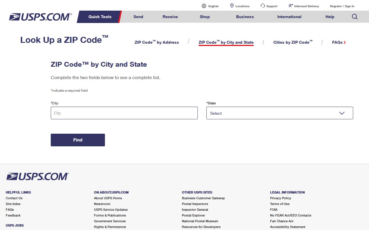
The image belongs at the start of the chain because it confirms delivery formatting, while later county and city sources answer ownership and jurisdiction.
| USPS input or result | What to record | What it does not prove |
|---|---|---|
| Street address | Number, street, unit when applicable | Parcel ownership |
| City and state | Postal locality and Georgia | Incorporation in Woodstock |
| ZIP Code | Five-digit delivery area | Ward or precinct |
| ZIP+4 | More specific delivery segment when returned | Household membership |
Find Woodstock Residents Within One ZIP Code
No authoritative local records portal was confirmed to provide a public ZIP-wide filter. The responsible workflow starts with ZIP geography, then narrows to an address or authorized record request instead of pretending that one search returns everyone.
- Confirm the exact delivery address and five-digit code in USPS. A city-and-state list is useful for orientation only.
- Enter the standardized street in the Cherokee assessor. Record situs, parcel ID, current assessed owner, owner mailing address, tax district, and legal description.
- Open the tract in Cherokee or Woodstock GIS. Compare parcels with city limits, wards, precincts, zoning, and service layers as needed.
- If voter data is relevant and use is lawful, request the existing public list fields from Cherokee Elections. Georgia My Voter Page is for a voter’s own verification, not a ZIP-wide people search.
- Once a specific road is known, continue with the Woodstock street directory rather than stretching a postal area into household evidence.
For a record that is not exposed online, contact the responsible office or make a written Georgia Open Records Act request for an existing export. The Act does not require an agency to create a new ZIP compilation.
Four Address Keys Behind Woodstock ZIP Searches
Several “addresses” can appear for the same parcel, and each serves a different purpose. Keeping them in separate notes prevents false matches.
- ZIP and ZIP+4
- The five-digit postal area and a more exact delivery segment assigned by USPS.
- PO-box ZIP
- A code reserved mainly for post-office boxes; none was verified as a separate Woodstock code.
- Unique ZIP
- A code assigned to one high-volume organization; none was confirmed for Woodstock.
- Carrier route
- An operational delivery path within a ZIP, not a city boundary or resident roll.
The assessor’s situs address locates physical property. The owner mailing address receives tax notice and may be elsewhere. A legal description identifies the land by subdivision, lot and block, land lot and district, or metes and bounds. The postal city and code route mail. A ZIP code directory must not collapse those four keys into one.
Woodstock ZIP Code Boundaries and City Limits Diverge
Large parts of 30188 and 30189 lie outside incorporated Woodstock. This is the defining geographic fact for the page. It affects the right office for city police, permits, open records, wards, and municipal services, but it does not change Cherokee County custody of deeds, property assessment, probate, and county election records.
Geography check. Treat “Woodstock” on mail as a delivery label until the parcel is tested against a dated city-boundary layer.
USPS ZIP areas are operational routes, while Census ZCTAs are statistical approximations. A population reported for ZCTA 30188 or 30189 includes places beyond Woodstock and must not be presented as the city’s population. Precinct and ward totals also cannot become ZIP totals without a documented crosswalk.
Use Woodstock GIS for Jurisdiction, Not ZIP Assumptions
After USPS standardizes the address, search it in the Cherokee GIS Tax Parcel Viewer. The address geocoder zooms to the location; a parcel or tax ID returns the exact tract; Identify reveals parcel attributes; and the layer tree supplies parcels, zoning, districts, elections, utilities, and other context. Woodstock GIS adds city limits, wards, and historical ordinances.
The city’s future-development boundary metadata can be reviewed at its official ArcGIS service.
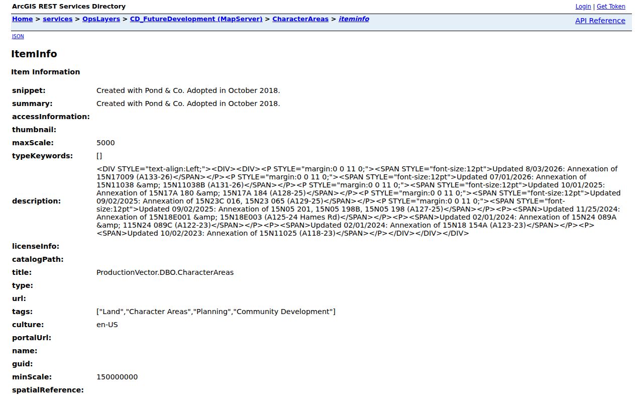
The capture shows why a dated parcel layer is more useful than a broad postal label when a record request depends on city jurisdiction.
Map layers identify land and service assignment, not residents. Record the service update date and displayed parcel number, then verify any key conclusion with the responsible office.
Woodstock Annexation Does Not Relabel the Mail
Woodstock’s GIS records parcel additions without requiring USPS to rename the delivery city or change the ZIP code. Metadata includes Hames Road parcels on November 25, 2024, additions in September and October 2025, and updates in July and August 2026. That chronology is unusually useful for deciding which municipal custodian held a permit or ordinance record on a particular date.
An annexation case ID and parcel number can seed a narrow public-record request for the ordinance, legal description, and staff report. The parcel’s Cherokee deed and tax custody stays with the county. This is a stronger account of address continuity than claiming a citywide renumbering event, since no official Woodstock renumbering year was found.
Voter Records Do Not Form a Woodstock ZIP Roll
Georgia My Voter Page is an identity-gated self-service tool. A voter can confirm registration status, residence information held for that registration, precinct, polling location, districts, sample ballot, and absentee information. Public voter lists are requested separately through Cherokee County Elections and Voter Registration.
Even an authorized list grouped by postal code would represent registered voters, not all residents. It can contain inactive or stale entries, and VoteSafe protects qualifying residence addresses. Keep the file date, status field, and confidentiality gaps visible. Never infer that an address has no residents merely because no voter row appears.
The Cherokee elections source is shown below.
It points ZIP-based research back to the county office that administers Woodstock registrations, while protected addresses remain properly absent.
What a Woodstock ZIP Code Directory Cannot Claim
A five-digit code cannot establish city residence, parcel ownership, household membership, ward, precinct, school assignment, or service provider without another source. It also cannot turn a broad statistical ZCTA into Woodstock city data. The safest notes preserve the USPS result, assessor situs, parcel identifier, GIS jurisdiction, and date as separate evidence.
Use ZIP-based research for lawful family history, civic study, reconnecting, estate work, and property questions. Respect VoteSafe and any other confidential address treatment. If a public source appears wrong, ask the custodian responsible for that source to review it rather than attempting to correct a postal or parcel mismatch through an unrelated directory.